You are here: Home > Heritage > Digital maps
Heritage
Home
Explore thousands of images and more with Canterbury Stories
Discover your family’s history at our libraries
Click on Thumbnail to view enlargement ~ Title index ~ Printing Tips
Previous Page ~ Next Page

 Discover your family’s history at our libraries
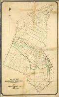 Map of the Riccarton Road Dist
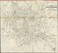 Map of Christchurch
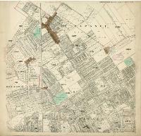 Map of the city of Christchurch
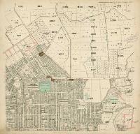 Map of the city of Christchurch
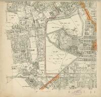 Map of the city of Christchurch
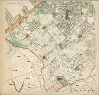 Map of the city of Christchurch
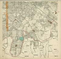 Map of the city of Christchurch
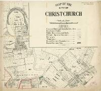 Map of the city of Christchurch
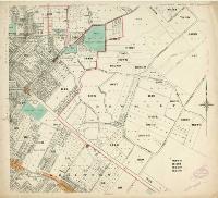 Map of the city of Christchurch
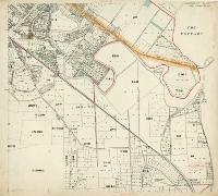 Map of the city of Christchurch
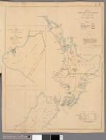 Map of New Zealand shewing approximately the extent of land acquired from the Natives
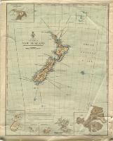 The colony of New Zealand
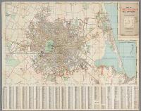 Map of Christchurch and environs
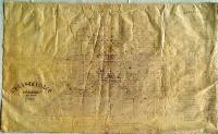 Christchurch, Canterbury, New Zealand, 1862
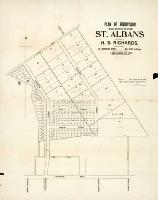 Plan of subdivision of rural sections no. 217 and 218, St. Albans, for sale by H.S. Richards